|
June 29, 2014
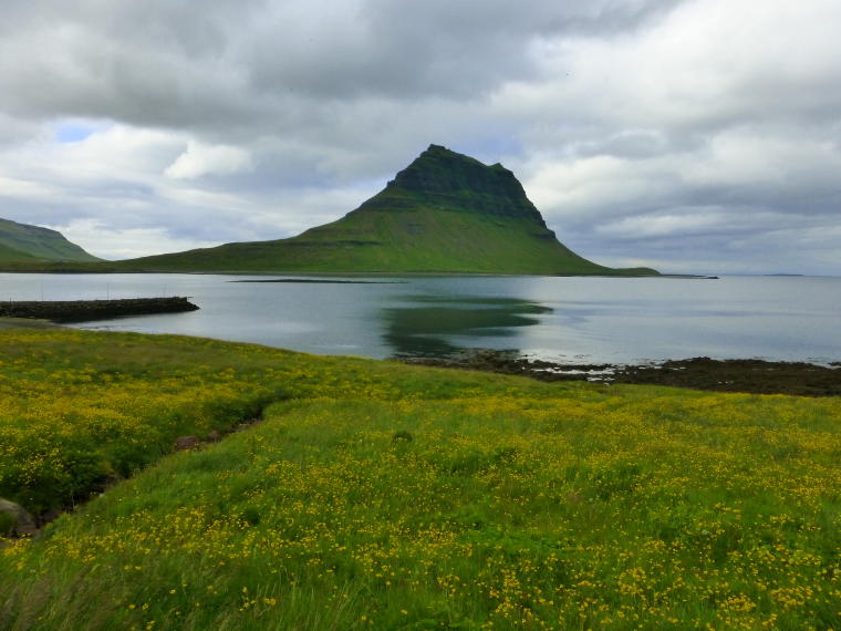
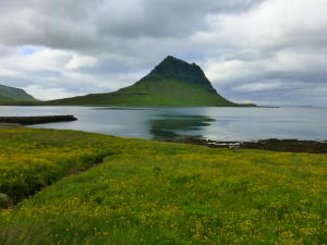
We left the hotel at 8:30 for our trip around the Snaefellsnes
Peninsula. It is named for the 5000 foot mountain that is capped
by a glacier. The area marks the entry point to Jules Verne's "Journey
to the Center of the Earth." Unfortunately, the clouds hung
low over the mountain all day (which we understand is typical) so
we could not see the top. But fortunately the weather cooperated
for our activities with only a short drizzle during one of our hikes.
It is still cool with light winds but everyone came prepared for
the weather.
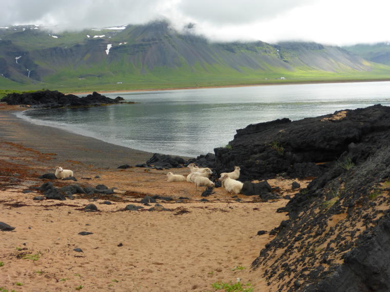
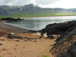 Our
first stop was on the south side of the peninsula in the town of
Boudir. In the old days, this was the sight of a marketplace where
merchants traded with the fishermen who brought their catches in
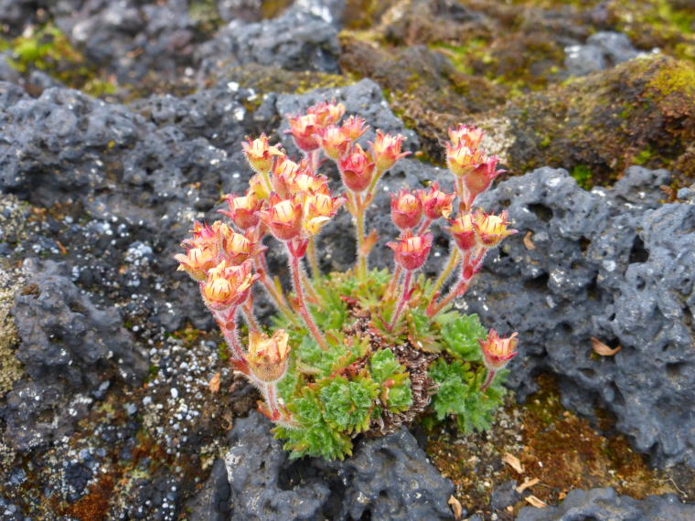
for goods. We walked down to the beach where we saw some sheep lying
by the water's edge. Again the wildflowers were abundant and the
lava outcroppings made for some dramatic sights. Our
first stop was on the south side of the peninsula in the town of
Boudir. In the old days, this was the sight of a marketplace where
merchants traded with the fishermen who brought their catches in
for goods. We walked down to the beach where we saw some sheep lying
by the water's edge. Again the wildflowers were abundant and the
lava outcroppings made for some dramatic sights.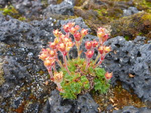
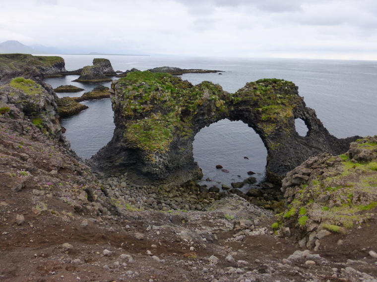
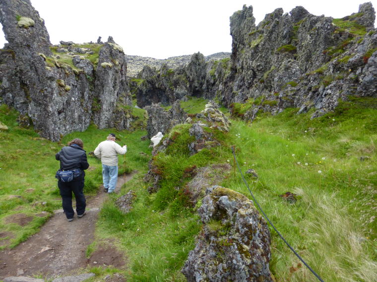
 A
little further down the road we stopped at the abandoned fishing
village of Arnarstapi for a 1.5 mile hike to the town of Hellnar.
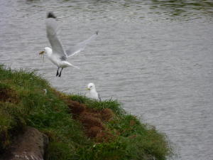
The hike was really interesting as it was on the bluffs above the
ocean. Initially we passed huge lava cliffs with nests of Kittiwakes,
Fullmars and Cormorants. A
little further down the road we stopped at the abandoned fishing
village of Arnarstapi for a 1.5 mile hike to the town of Hellnar.
The hike was really interesting as it was on the bluffs above the
ocean. Initially we passed huge lava cliffs with nests of Kittiwakes,
Fullmars and Cormorants. 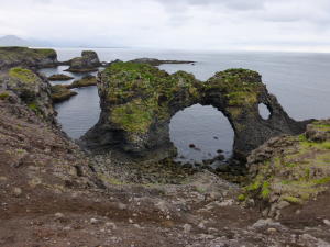 Then
the trail took us over and through lava fields with views of interesting
formations along the coastline. In Hellnar we had lunch at a cute
little restaurant whose specialty was a delicious fish soup, homemade
bread and a yummy blueberry mousse-like pie for dessert. Our bus
met us there so we didn't have to hike back. Then
the trail took us over and through lava fields with views of interesting
formations along the coastline. In Hellnar we had lunch at a cute
little restaurant whose specialty was a delicious fish soup, homemade
bread and a yummy blueberry mousse-like pie for dessert. Our bus
met us there so we didn't have to hike back.
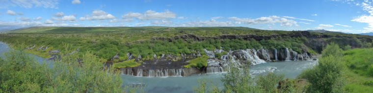
 After
lunch, we continued around the tip of the peninsula and headed back
along the north side. Although we could not see the Snaefellsnes
Glacier we did see many other cones of extinct volcanoes and lots
of waterfalls. After
lunch, we continued around the tip of the peninsula and headed back
along the north side. Although we could not see the Snaefellsnes
Glacier we did see many other cones of extinct volcanoes and lots
of waterfalls.
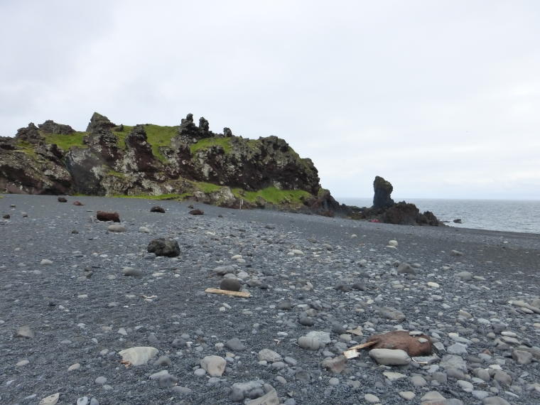
We then stopped in Dritvik for a hike down to the beach.  This
was the largest spring fishing station in Iceland. The bay is surrounded
on three sides by lava. The beach was the main landing site for
fishing boats (rowing). 40-60 boats were based here with 200-600
men working. This
was the largest spring fishing station in Iceland. The bay is surrounded
on three sides by lava. The beach was the main landing site for
fishing boats (rowing). 40-60 boats were based here with 200-600
men working. 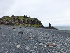 The
beach still has the remains of the 10 fishing huts and fishing gear
scattered about. They are considered historical artifacts so cannot
be moved. The
beach still has the remains of the 10 fishing huts and fishing gear
scattered about. They are considered historical artifacts so cannot
be moved.
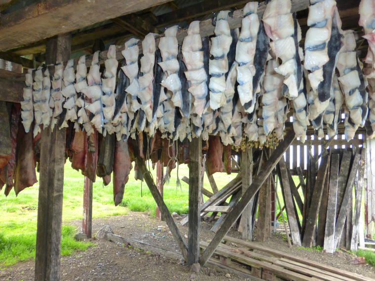
 Our
final stop was to a shark farm where they age Greenland Shark meat.
The fish is poisonous unless prepared in this way and it is considered
an Icelandic delicacy. It is served with a cube of rye bread, then
the cube of shark, followed by a shot of Brenniven (Black Devil)
which is a strong 35 proof potato alcohol. The shark wasn't bad
but we really enjoyed the Brenniven! To see a short video of Fred
sampling the shark, click here. Our
final stop was to a shark farm where they age Greenland Shark meat.
The fish is poisonous unless prepared in this way and it is considered
an Icelandic delicacy. It is served with a cube of rye bread, then
the cube of shark, followed by a shot of Brenniven (Black Devil)
which is a strong 35 proof potato alcohol. The shark wasn't bad
but we really enjoyed the Brenniven! To see a short video of Fred
sampling the shark, click here.
We made it back to the hotel about 5:30 after a very interesting
day. Some folks took the optional boat ride around the bay but we
opted for a very nice dinner in town.
To view more photos from the Snaefellsnes Peninsula, please go
to Snaefellsnes Photo Gallery.
To read about the next location visited, go to Akureyri.
Home
Locations Visited Photos Map
Contact Us
|